GPR Utility Detection Surveys involve identifying specific underground utilities using a combination of advanced, non-intrusive survey techniques.
These methods include:
– Ground Penetrating Radar (GPR)
– Electromagnetic Location (EML)
– Pulse Wave generator (PWG)
– Sonde and Reel Tracing
These combined techniques ensure comprehensive and accurate detection of underground utilities.

Geo-radar - High Density Array acquisition
GPR Systems provide a highly efficient solution for comprehensive subsurface investigation, especially for detecting underground utilities and structures.
This advanced technology captures detailed data with high-resolution scans, ensuring full coverage of the survey area
Mala Mira 500 HDR High Density Array 132 Antenna Radar
The MALA MIRA 500 HDR is designed for large scale 3D mapping projects to produce superb data quality at high speeds. The wide coverage and the highest channel density on the market means fewer passes and higher resolution.
The flexible solution, providing 132 possible data channels and a minimum channel spacing of 6.5 cm, delivers 32-bit data with the highest resolution on the market.

Mala Mira 500 HDR High Density Array with field trailer
IDS C-Stream – High Density Array - 32 Antenna Radar
The IDS C-Stream is 34 antenna High Density Array radar with a frequency of 600MHz and provides a solution to acquire data in more restrictive areas to M4P PAS 128:2022 standard.
The Stream C provided a compact array solution for 3D mapping of underground utilities and features. Increased levels of accuracy are provided by a large antenna array to automatically detect pipes and cables.

IDS C-Stream – High Density Array - 32 Antenna Radar
Geo-radar Single Dual Channel
IDS Opera Duo is a Ground Penetrating Radar with a dual frequency of 200MHz and 700MHz to allow greater penetration.

IDS Opera Duo
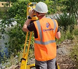
Electromagnetic Location (EML)
EML is one of the two technologies that are mandatory when carrying out a PAS128 Survey Type B (Detection).
A full Electromagnetic Location (EML) survey is completed in the area of investigation using a Radio detection RD8000 receiver and transmitter together with sondes tracing, induction, tracer cables, and induction clamps with the results recorded and plotted on the surveyed sheet .
These results were then compared and combined with the GPR scan capture during the post processing phase.

Electromagnetic Location (EML)
Post Process of Ground Penetrating Radar (GPR) data
Ground Penetrating Radar (GPR) data was post processed to improve the interpretation of raw data using GRED HD GPR and MIRAsoft HDR Post processing software.
Post processing aids in the identification of responses indicative of the presence of underground utilities or underground anomaliesin order to gain a better understanding of areas of complex or more obscure utility networks.
In addition there is the added advantage of acquiring a digital record of what work was carried out in the field.

MIRAsoft HDR Post processing software
What is PAS 128
PAS 128 is the recognised BS standard for underground utility detection surveys. It sets out the specifications and best practices for how surveys are carried out, how data is interpreted, and how results are reported.
At Geodata, we carry out all utility detection surveys in full compliance with PAS 128:2022 (Specification for underground utility detection, verification and location).
PAS 128 Survey Quality Levels
Each PAS 128 survey is assigned a Quality Level (QL), which indicates how the information was obtained and how accurate it is:
– QL-D – Desktop utility record search only (no site work).
– QL-C – Utility positions estimated from record data and site features.
– QL-B – Utilities detected using geophysical techniques (EML and/or GPR).
– B1–B4 subcategories indicate confidence and positional accuracy.
– QL-A – Utilities physically verified and measured (e.g. by excavation or exposure).
Deliverables
– 2D/3D .dwg
– 3D Utility Models (BIM Ready)
– Survey Report
– Photographic Records
.