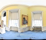
At Geodata, we specialise in the high definition laser scanning of heritage and conservation sites, capturing intricate architectural and decorative details with exceptional accuracy.
Using advanced laser scanning technology, our team records every aspect of a structure, from fine ceiling artistry and ornate mouldings to timber panelling, stone carvings, and façade details, preserving essential information without any physical intervention.

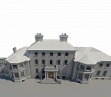
Our experienced modellers transform the captured point cloud data into precise BIM and CAD deliverables, tailored to the conservation requirements of each project.

We produce conservation grade drawings and 3D models in a variety of formats, providing a dependable digital record for restoration, analysis, and long term heritage management.
Deliverables
– Point Clouds .rcs, .e57, or .las formats.
– 2D Conservation Drawings
– Stone by stone drawings suitable for heritage documentation.
– 3D BIM & CAD Models
– High resolution orthographic imagery ideal for façade condition surveys and restoration design.