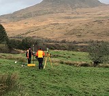
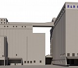
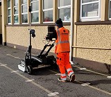
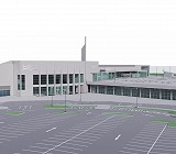
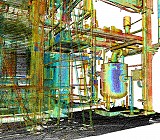
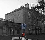
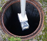
Geodata Surveying Ltd

Menu

  • About Us
  • Services
    • Topographical Surveys
    • Measured Building Surveys
    • 3D Modelling & Bim Surveys
    • Laser Scanning
    • Conservation & Heritage Surveys
    • GPR Utility Surveys & Mapping
    • Inspection of Confined Spaces
    • Setting Out & Monitoring
    • Land Registry & Legal Mapping
    • Hydrographic Surveys
    • Volumetric Surveys
    • Drone Surveys
  • Case Studies
    • Hunt Museum
    • Cahercon House BIM Model
    • Plant Room, 3D Laser Scanning
    • Limerick Smarter Travel
    • Maldron Hotel BIM Model
    • Carpark, Cherrywood, Dublin
    • Riverstick Topographical Survey
    • Mallow Sewerage Scheme
    • Pharmaceutical plant
  • Clients
  • Contact Us

Services

  • Topographical Surveys
    Topographical Surveys
  • Measured Building Surveys
    Measured Building Surveys
  • 3D Modelling & Bim Surveys
    3D Modelling & Bim Surveys
  • Laser Scanning
    Laser Scanning
  • Conservation & Heritage Surveys
    Conservation & Heritage Surveys
  • GPR Utility Surveys & Mapping
    GPR Utility Surveys & Mapping
  • Inspection of Confined Spaces
    Inspection of Confined Spaces
  • Setting Out & Monitoring
    Setting Out & Monitoring
  • Land Registry & Legal Mapping
    Land Registry & Legal Mapping
  • Hydrographic Surveys
    Hydrographic Surveys
  • Volumetric Surveys
    Volumetric Surveys
  • Drone Surveys
    Drone Surveys
  • Geodata Surveying Ltd
  • 47 Oliver Plunkett Street, Bandon, Co. Cork, P72 A443, Ireland
  • Tel: +353 (0)23 88 52798 | Email: info@geodatasurveying.ie
  • Society of Chartered Surveyors Ireland logo
  • Contact Us
© Geodata Surveying Ltd 2023. All rights reserved. Design by Duck to Water, Website by Bristlebird
Back to top